Quickly adjust the chart view with simple zooming, panning, and rotating chart.
Abstract
EcWidget::mouseEvent(QPoint point)
Ownership Centering
Ownship Centerd
About
Keep your vessel in focus at all times, whether fixed in the center or with a look-ahead view for safer planning.
Abstract
Ownship::onCentered(bool checked)
Ownership Centering
Head-Up Orientation
About
Head-Up Orientation is an ECDIS mode that keeps the ship’s heading at the top of the display.
Abstrack
Head-Up Mode: Ownship::onHeadUp(bool checked)
Ownership Centering
North-Up Orientation
About
North-Up Orientation is an ECDIS mode that keeps true north fixed at the top of the display.
Abstract
North-Up Mode: Ownship::onNorthUp(bool checked)
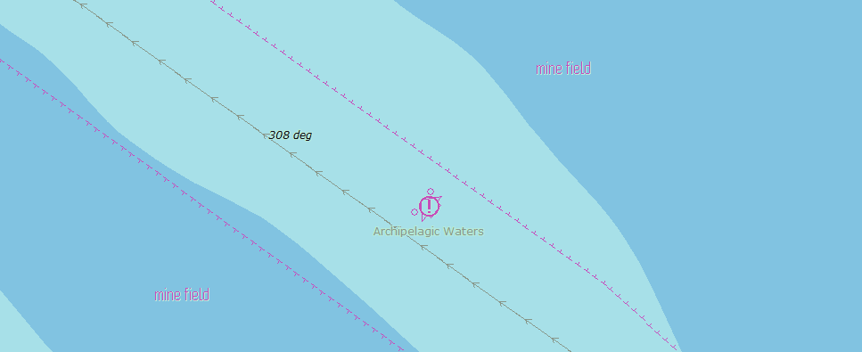
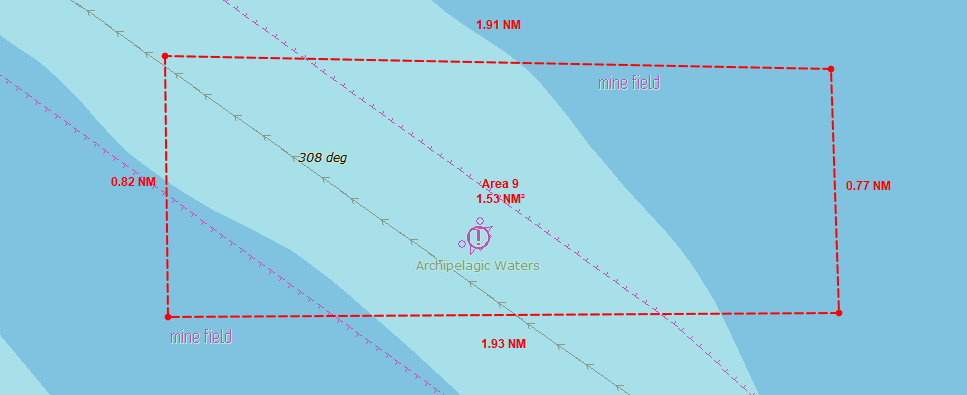
Area Object
Create Area
About
Create Area is an ECDIS function used to draw and define a custom area on the chart for monitoring, alerts, or route planning.
Abstract
Area::create()
Area Object
Remove Area
About
Remove Area is an ECDIS function used to delete a previously created area from the chart.
Abstrack
Area::removeNode(EcCoordinate)
Measurement
Create Measure
About
Create Measure is an ECDIS function used to measure distance, bearings, or ranges directly on the chart.
Abstract
Measurement::create()
Measurement
Unit Config
About
Unit Configuration is an ECDIS function used to set and adjust measurement units for distance, depth, speed, and other display values.
Abstrack
Measurement::unitManage(int option)
Measurement
Remove Measure
About
Remove Measure is an ECDIS function used to delete an existing measurement from the chart.
Abstract
Measurement::remove(EcCoordinate)
Sensor Handling
Draw Ownship
About
Draw Ownship is an ECDIS function used to display the vessel’s current position and heading on the chart.
Abstract
Ownship::draw(bool)
Sensor Handling
Navigation Info
About
Ownship Detail Info is an ECDIS function used to display detailed information about the vessel’s current position, heading, speed, and status.
Abstrack
Ownship::navInfo(navShip)
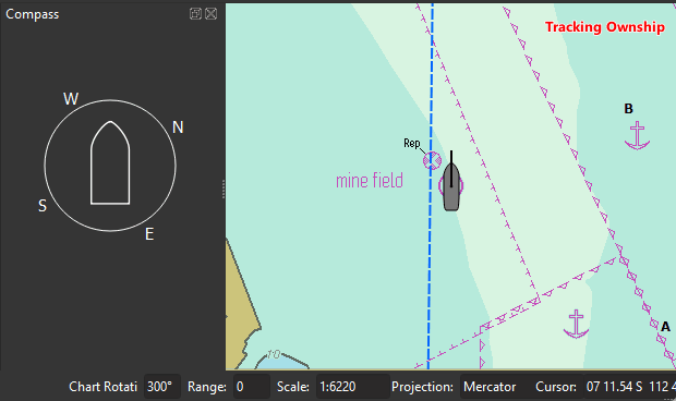
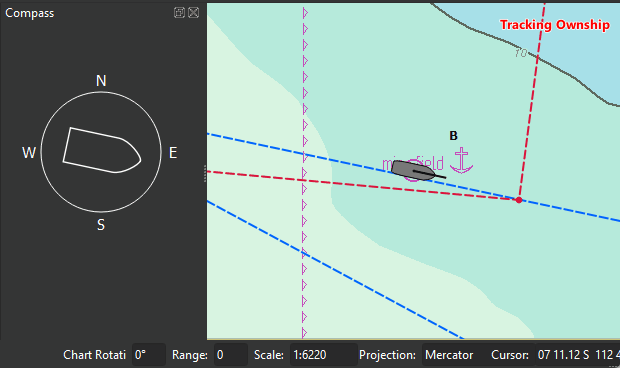
Sensor Handling
Compass
About
Compass is an ECDIS display element that shows the vessel’s heading and directional reference.
Abstract
Ownship::compass(bool)
AIS Target Display
AIS Target
About
Draw AIS Target is an ECDIS function used to display AIS targets on the chart, showing vessel positions and related information.
Abstract
Ais::readAisVariable(String nmea)
AIS Target Display
AIS Detail
About
Get AIS Detail Data is an ECDIS function used to view detailed information from an AIS target, such as vessel name, MMSI, course, speed, and status.
Abstrack
Ais::pickAisDetailData(String mmsi)
Routing
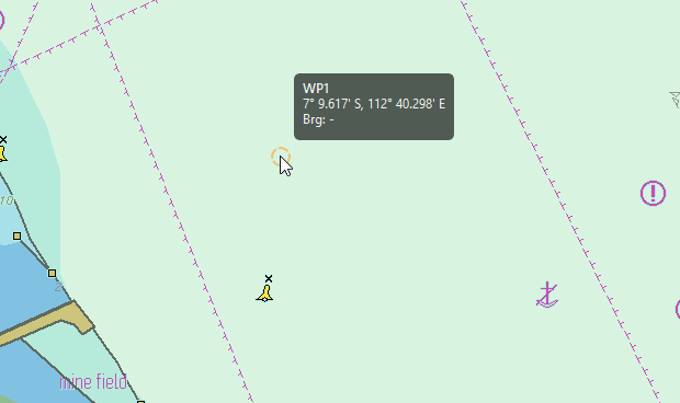
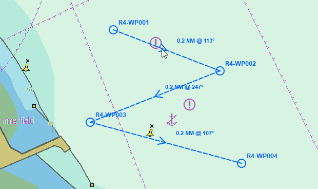
Create Waypoint
About
Create Waypoint is an ECDIS function used to add a new waypoint on the chart for route planning.
Abstract
Route::createWaypoint()
Routing
Remove Waypoint
About
Remove Waypoint is an ECDIS function used to delete a selected waypoint from a route.
Abstrack
Route::removeWaypoint(EcCoordinate)
Collision Avoidance
CPA/TCPA Calculation
About
CPA/TCPA Calculation is an ECDIS function used to compute the closest point of approach (CPA) and the time to reach it (TCPA) between your vessel and another target for collision risk assessment.
Abstract
CPATCPA::calculate()
Collision Avoidance
Dangerous Box Warning
About
Dangerous Box Warning is an ECDIS alert that triggers when an AIS target enters a predefined “danger box,” helping the navigator avoid unsafe CPA/TCPA situations.